The mouth of the Sackville River was once a popular hunting and fishing ground among the Mi’kmaq people. Fish and shellfish were plentiful in the basin they called Chebucto, which translates into “The Great Harbour”. The Mi’kmaq had an ancient portage route that connected the rich supply of resources in Chebucto Harbour with the Minas Basin and Cobequid Bay. However, once Europeans settled the region, the name Chebucto was eventually replaced by Aloosoolawakade, which means, “place of the measles”.
The Mi’kmaq had to abandon the ancient trail but the Acadians of Piziquid (now Windsor) adopted the route for shipping goods to Louisburg, in Cape Breton. When the English arrived, in force, during the summer of 1749 they took advantage of this link provided between their newly established Halifax and Fort Edward.
 While founding the British colony, the Governor of Halifax felt compelled to build defensive outposts and lookouts for the main fortification at Halifax. One of these essential outposts was Fort Sackville, which was built near the mouth of the Sackville River on the Chebucto Basin. One of its purposes was to guard against the Mi’kmaq, who were feared as a potential threat. The second purpose was to defend the “Great road” which led to the Minas Basin. It was feared that the French might use their old shipping route in an attempt to take Halifax. The fort was named after Lionel Cranfield Sackville, the first Duke of Dorset, and the man chosen to command this fort was Capt. John Gorham. John Gorham and a band of some sixty rangers constructed the fort and shortly thereafter people began to settle around it and this new community became known as ‘Sackville‘.
The road to Annapolis was originally 18′ wide, which was increased to 40’ in 1779 to meet the standards for a designated post road. These main roads were also required to have, “a trench to be dug on the upper side of the road, when necessary- on both sides; to be rounded in the middle, at the hollow places to be bedded with stones where they are to be had, and, when they, cannot be had, to be brushed arid graveled; all bad hills, where they are judged necessary; to have the tops taken off and carried into the hollow to make an easy ascent; the trees and bush to be cut down twenty feet wide on each side of the read from the centre; all short turns and bad hills to be altered where judged necessary.” (W. R. Bird, History of the Highways of Nova Scotia) As time passed the volume of traffic on the road increased and it was continually upgraded. Survey maps from 1815 to 1830 indicate recommendations to provide an easier gradient for carriages and to avoid swampy areas where moisture was a problem year-round. During that same time frame, 1828, Joseph Howe spent a night at Fultz’s Inn in Sackville, while traveling to the Annapolis Valley. Howe took in the scenery and noted the beautiful hills that surrounded the community. Apparently he was of the opinion that the road should have surmounted some of those hills, to take in the view, rather than avoiding challenging slopes. If the road surveyors of the past had foreseen the succession of our modern highways and motor vehicles, perhaps the visionaries among them might have been more inclined to plan a road that rose to the crest of some hills for travellers’ viewing pleasure and sparing the rivers and streams from highway runoff.
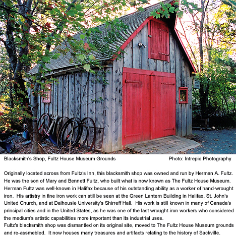
The Fultz Inn was one of many Inns that began to crop up along the road in the early 1800’s. Starting in 1801, the legislative Assembly offered grants of £25 to settlers along main roads who would clear 5 acres of land and build a house (no less than 16’x22’) with the intention of providing shelter for passing travelers. Almanacs of 1816 and 1817 recorded lodging opportunities at Mitchell’s, Springfield, Ellington, Pence’s Farm, Woods, and Montague House on the way to Windsor. Similar opportunities were had along the road to Truro. This, the second “great road” to meet at the Sackville juncture, did not open until the 1760’s and it would remain a rather crude trail until the following century. Both of the great roads were apt to be impassable during the rains of spring and fall. The Highways No.1 and No.2 of present day were paved on roughly the same courses that the historic great roads followed. In addition to rooms these Inns also provided food for travelers and stabling for their horses. Regular weekly stagecoach services, which began in 1816, would change horses every 15 miles to maintain reasonable speeds through the long journey.
Most houses along the road were modest farmsteads where settlers tended crops and livestock for subsistence or trade. There were a few wealthy estates on the Bedford Basin and near Mount Uniacke was the private estate of the Attorney General, Richard John Uniacke. Industry in the region was limited to tanneries, a few sawmills, and gypsum and limestone quarries.
More Recently
In 1999, Sackville celebrated its 250th anniversary since it’s founding in 1749. For the first 220 years the community slowly evolved as a rural community populated mostly by farmers. This population had reached approximately 3,000 by the late 1960’s. In 1963 the germination of an abrupt change in growth occurred when a housing study identified the area as suitable for urban residential development. In 1967 the Nova Scotia Department of Housing began land banking in the area and building municipal central sewer and water facilities. With this Sackville became a logical solution to the increasing housing demands in the cities of Dartmouth and Halifax. This was confirmed by the Halifax-Dartmouth Regional Planning Commission in 1969 and reflected in the Halifax Dartmouth Regional Development Plan of 1975. This Plan emphasized the importance of balancing a community with commercial and industrial areas, parks, and efficient transportation connections with the cities of the neighbouring communities. By this time residential developments for middle to lower class homeowners were rapidly taking over the picturesque hills that drain into the Sackville River. In 1992 rapid growth had brought the population of Sackville to approximately 30,000. Today in 2003, there are approximately 40,000 in Sackville and approximately 10,000 of them live within walking distance of downtown Sackville.
Census Canada (1991) found that this community was relatively young, with the proportion of all population sectors below the age of 45 being at or above the provincial averages while the opposite was true for the proportions in older sectors. Sackville is still attracting a significant proportion of the first-time homebuyers in the metro region. Initially, much of the work force was commuting to work in Halifax or Dartmouth Fortunately the community has grown to boast about high employment rates, and a reputation as a regional recreation centre. One of Sackville‘s longstanding claims to fame was the Sackville Downs, a harness racing oval located on the land that is now occupied by the Downsview Mall at the Beaver Bank Road.
Commercial growth has shown a steady growth since 1982. The commercial success of Sackville Drive is obvious to anyone who has driven the street, which is busy at all hours of the day and night. Retail shops have proliferated along most of the 4.5 kilometres between the Cobequid Road and the Beaverbank Road and the parking lots associated with these businesses are just as crowded as the street. Commercial growth was slower to start than residential development and it is still lagging behind. Through the 1980’s, commercial and industrial properties made up approximately 15% of the Sackville tax base, which made residential property taxes high relative to other neighbouring communities. However, the proportion of commercial and industrial property has increased significantly in recent years.


Recent Comments